
Page 6 - Using Economic and Resource Maps
P. 6
People use maps for different reasons. Drivers might
use a map that shows roads to keep from getting lost. A
traveler may look at a map that shows countries to find
out what nations border Kenya—the next place she plans
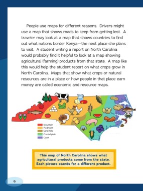
to visit. A student writing a report on North Carolina
would probably find it helpful to look at a map showing
agricultural ( farming) products from that state. A map like
this would help the student report on what crops grow in
North Carolina. Maps that show what crops or natural
resources are in a place or how people in that place earn
money are called economic and resource maps.
Mountain
Piedmont
Sand hills
Coastal plain
Coast
This map of North Carolina shows what
agricultural products come from the state.
Each picture stands for a different product.
6